As usual, each "thumbnail" picture is linked to the larger version.
Back to Tim's Home Page - All pictures Copyright 2000 Tim Hilliard
![]() NEWS FLASH - new Guate pictures, March 2004 at this link!
NEWS FLASH - new Guate pictures, March 2004 at this link! ![]()
| I took a 2 1/2 week trip to Guatemala in Feb. 2000, no where near long enough
to get to know the place but I did get some good pictures.
Click here to view a nice map of Guatemala. I was entirely in the highlands, and didn't see the ruins everyone expects. In any case, here's a selection of pictures with some commentary. I was there for two work-weeks and all three weekends. I went to three different parts of the highlands on the three weekends. I flew in late on a Friday night to Guatemala City and took a shuttle to Antigua that night, getting to a hotel about midnight. I spent the next day entirely in Antigua, which was about all I could stand of tourists, high-pressure vendors, etc. However, it's one of the world's most beautiful cities, I believe, and I could spend longer there if I had a quiet space to retreat to, I guess. It is 470 years old, all the streets cobblestone, and is a world heritage site so even the Burger King has a restored colonial facade and only a small wooden sign. Vendors from the villages sell tourist items everywhere, tour guides recruit you, and there are tourists of every make and model all over town. Harrison Ford was there (it was the talk of the town), though the shuttle driver from the airport mangled his name so badly that I wasn't sure who he was talking about until he mentioned Indiana Jones). The heart of the town is the plaza, and colonial buildings, some in ruins, extend for many blocks in every direction. Part of the cathedral is still usable; most is in ruins, and very beautiful ruins at that. Nearly five centuries of earthquakes and volcanic activity have shaped the town and while seeming to destroy it, have somehow preserved it at the same time. Three volcanoes over the city remind you of the hands-on geology lessons the locals have had. I gave an English lesson, saw some of the old buildings, drank some wonderful coffee, and chatted with the high-school girls selling items from their home towns (there is a big boarding school for indigenous high school girls in Antigua). |
|
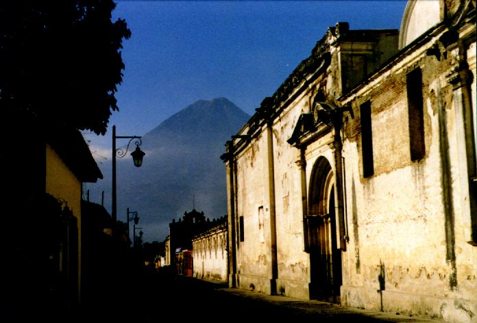
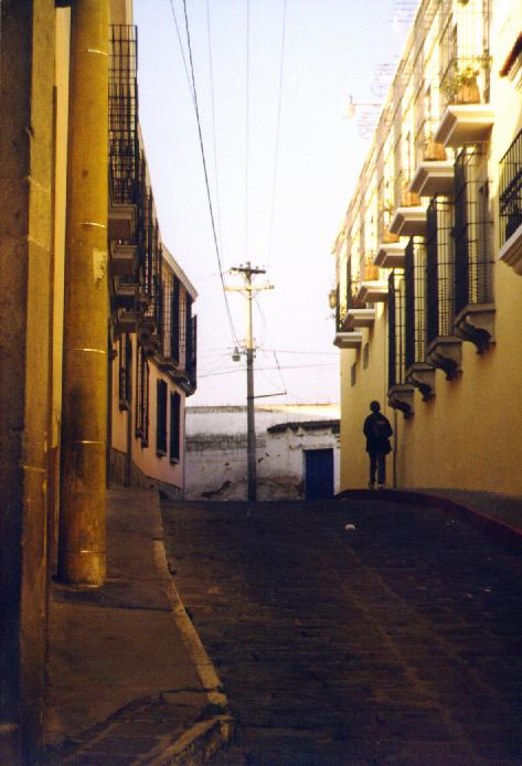
| Left: A typical quiet colonial street
in Antigua offers a vista of one of the three volcanoes.
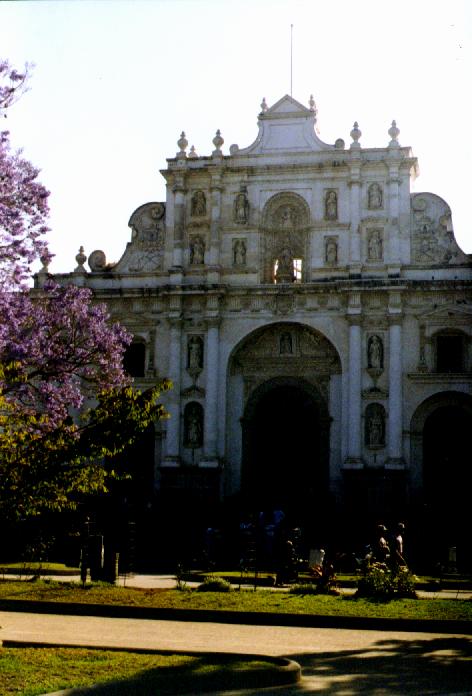
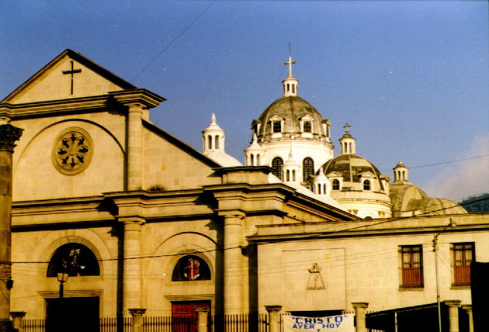
Right: Here is the facade of the Cathedral in Antigua. The cathedral is a remnant of the original - the front portion is restored and is now the main church, the rest behind in scenic ruins. I sat in the plaza for hours, smoking a big, tasty Cuban cigar (a Punch Churchill, one of the world's best). |
 |
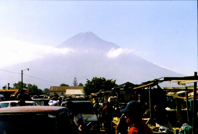
| Left: One of the volcanoes is appearing out of the
morning mist over the market in Antigua. This market isn't
a big tourist attraction because the type of tourists in Antigua are looking
for crafts, available anywhere in town, and the market is for clothes, food,
hardware, tools, etc. However, market lover that I am, I spent a couple of
hours poking around.
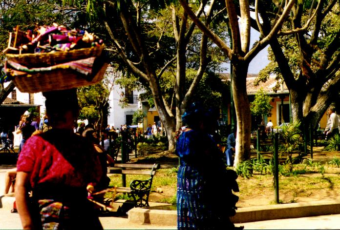
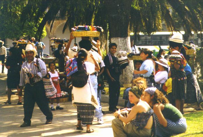
Right: A vendor with a basket of coin purses, eyeglass cases, dolls, etc. cruises the plaza in Antigua. The plaza is constantly full of such vendors, almost always women or girls, many high school students from a boarding school for indigenous students from all over the country that is located in Antigua. |
 |
|
Vendors and tourists mix on the shady plaza in Antigua on a Saturday. |
 |
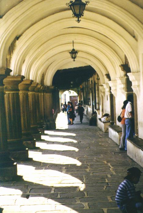
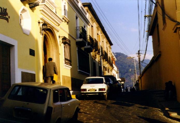
| Left: A colonial arcade facing the main
plaza in Antigua, now with several museums along it.
Right: Indigenous vendors, with a fine colonial building's facade across the street, sell hand-woven fabric and other goods near the back gate to the ruined portion of the cathedral in Antigua. |
 |
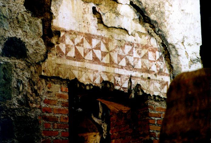
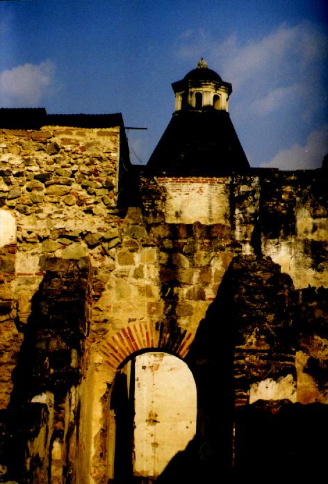
| Left: Brick, stone, and painted wall
remain in a portion of the ruined bishop's palace, Antigua cathedral.
Right: An archway and tower in the ruined bishop's palace, Antigua cathedral. |
 |
| I left Antigua Sunday morning and
took a crowded, ancient
American school bus (the transportation of choice everywhere in
the country) to Chimaltenango on the Interamerican highway,
where I caught another crowded, ancient bus to Quetzaltenango. Except on
maps, Quetzaltenango is almost always called Xela (pronounced SHELL-a), short for Xelaj�,
it's name in Mam, a Mayan language.
The road
to Xela goes over the highest pass in Central America, over 10,000 feet,
where there's a small village called Alaska. The forests along the route
include madro�a, alder, oaks, pines, and other familiar vegetation. Xela
itself is at about 8,000 feet in a big valley below Volc�n Santa
Mar�a.
Xela too has cobblestone streets and colonial architecture, but there is little tourism there with the exception of schools where people from the US and Europe come to learn Spanish and a variety of Mayan languages. I found the school I'd decided on (based on internet research) and dropped in on them, signing up for a couple of weeks. The school, Centro Maya De Idiomas, provides room and board (three meals a day, seven days a week, with a local family) and five hours a day of one-on-one instruction. They also include activities and excursions in the afternoons. They teach Spanish as well as K'iche', Kaqchikel, Tuzutujil, Q'anjob'al, and Mam. The school was in an old house in a dusty suburban area and I stayed with a family (a two year old, his mother, and his grandmother) in a little house only three blocks away. You can get anywhere in Xela by bus for half a Quetzal (the Quetzal is the monetary unit of Guatemala), and a Quetzal was worth 12.5 cents when I was there. However, the city has only a few hours of sites worth seeing and I was soon taking busses to more remote villages in the afternoons to escape boredom. |
|
| Left: Colonial buildings line a
cobblestone street in Xela - but most of Xela is modern, dusty and a
bit on the boring side.
Center: The cathedral in Xela Right: A restored, fancy hotel in the colonial part of Xela near the plaza. |
 |
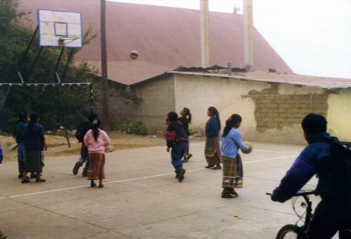
| Left: Indigenous grade school
children play basketball in the fog, at Escuela Nuevo Amanecer, in the
mountains above Cantel, near Xela. I went with people from my school to
teach English one afternoon, a fun experience.
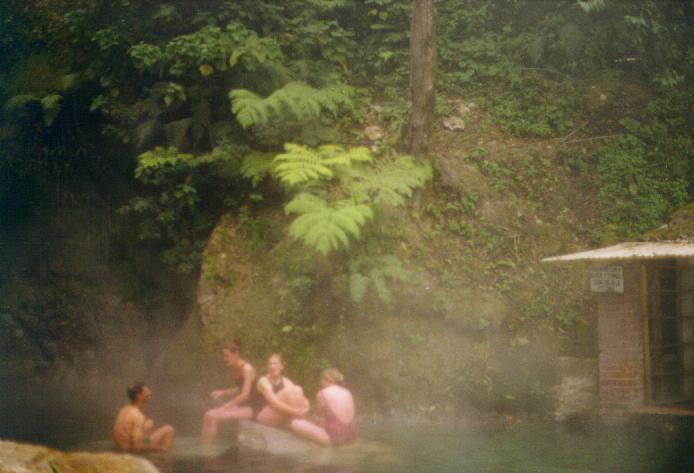
Right: Fuentes Georginas, a wonderful hot springs high in the mountains near Zunil. Another afternoon, some of us from the school went to the fuentes, which despite the altitude of about 9,000 feet are surrounded by tropical plants. Despite the tropical appearance, it was darn cold there! |
|
| I joined other students on some afternoon activities including visits to a wonderful hot spring (Fuentes Georginas, right), to a large indigenous village, and to a grade school where we taught an English class (left). We also visited the house where the six female indigenous college students live. These girls are on scholarships from the school and when they are more advanced in their studies, do some teaching (my teacher, Elsa, above, was a fifth-year student from the college who lived in the house). One day two of the college students and I climbed a small volcano in the afternoon for incredible views of the region. They almost choked laughing when a small boy at a shack on the trail saw them and ran for him mother shouting "gringas vienen" - "gringo girls are coming." Since they were both indigenous girls in full traditional clothing and I was still around the corner, I have no idea why he thought they were gringas but it sure entertained my guides. | |
| Zunil, an old village near Xela. The foggy mountains behind are the locale of Fuentes Georginas. In Zunil, I was first introduced to the Mayan-Catholic "saint" called Maxim�n most places (but San Sim�n in Zunil). There is a sanctuary in a dirt-floored hut in Zunil. I burned a yellow candle for my health - I was having intestinal pain and other symptoms of the revenge - and, much to my amazement, was feeling fine in about 20 minutes. Later I bought a well made figure of Maxim�n in another village and plan to build my own little sanctuary here - and another on the internet - to show my thanks. |  |
| Here's Maxim�n himself, sitting in my kitchen for the photo. This is his appearance as copied from the figure in the sanctuary at Santiago Atitl�n (where I bought the figure). In the picture are candles from Xela, blue woven / embroidered fabric from Chichicastenango, some old red Guatemalan fabric I've had for years, white pellets of pine-pitch incense, a Guatemalan cigar, and a bottle of cheap Guatemalan aguardiente (rum). | 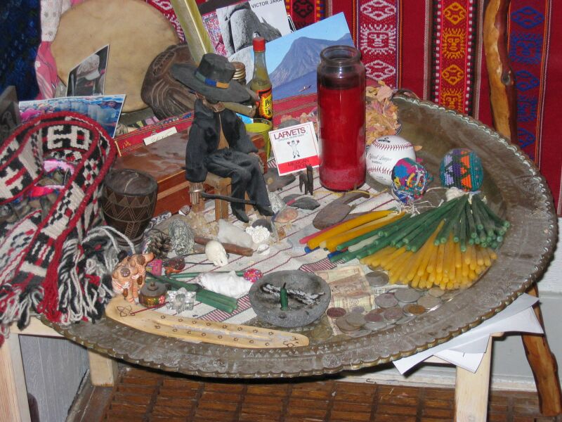
|
| My teacher Elsa stands in the doorway to the back patio of my school in Xela, Centro Maya de Idiomas. I studied one-on-one for 5 hours a day, stayed with a local family, and on afternoons there were outings or projects. I worked on verbs mostly, and some other grammar review, and conversational skills. A great experience! |  |
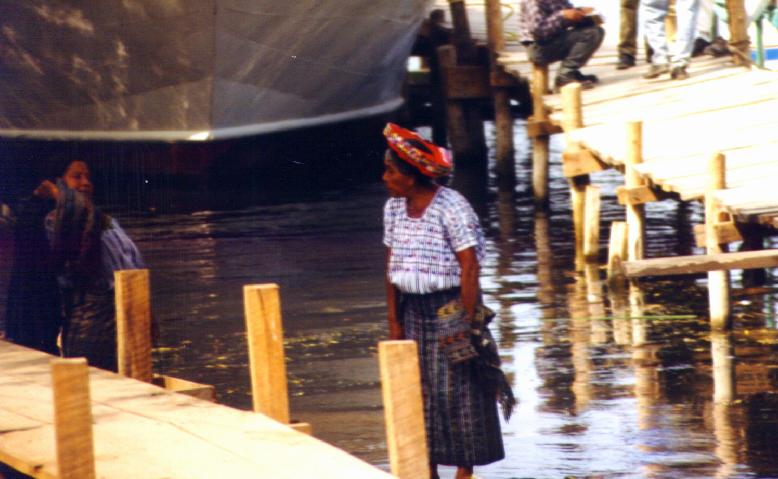
| I took the bus on a narrow, twisty, steep, wild trip from Xela to San Pedro la Laguna on Lago Atitl�n where I spent the weekend. The switchbacks were so tight the bus had to go back and forth to make the corners, while thousands of feet of open space was all I could see below. The switchbacks were so tight the bus had to go back and forth to make the corners, while thousands of feet of open space was all I could see below. The route went through remote villages and dropped to Lago Atitl�n, a large lake in a caldera with several volcanoes surrounding it. Most travel on the lake is by motor launch, and the village of San Pedro la Laguna is quiet and friendly, not a tourist nightmare like Panajachel on the other side of the lake (called "Gringotenango" locally). | |
| A boy sits in the window of his family's whitewashed adobe house watching the bus driver try to fix a flat on my bus - probably the most exciting thing that had happened all day in his tiny village (Santa Clara la Laguna near Lago Atitl�n). | 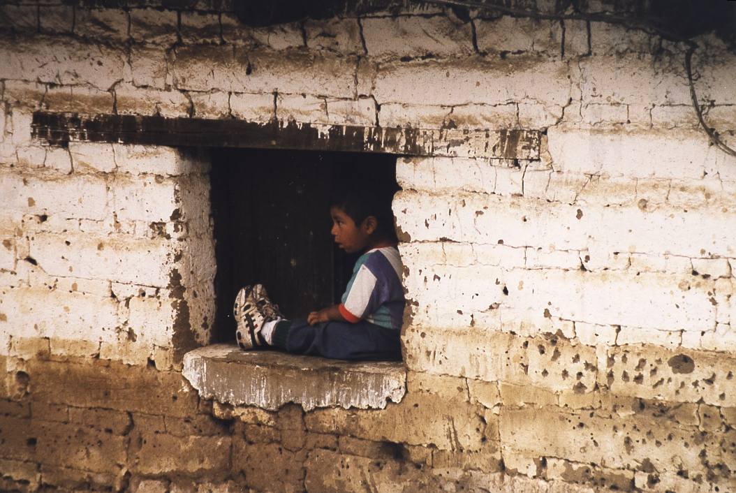 |
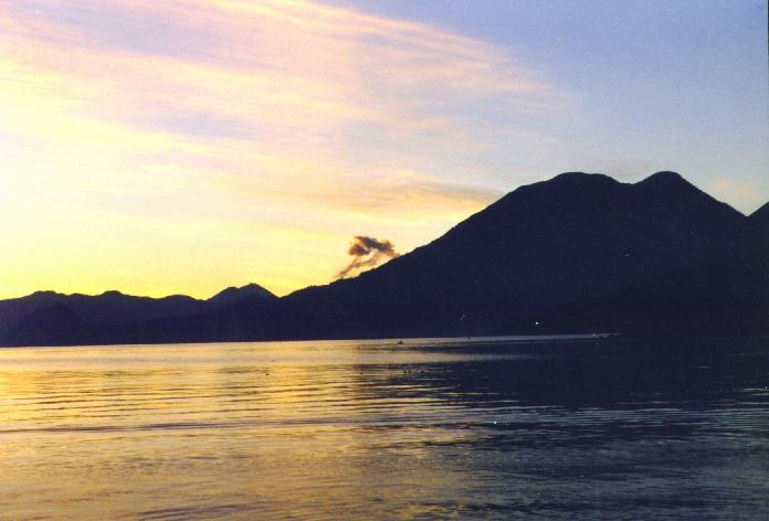
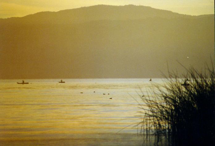
| On Saturday morning in San Pedro I was up before dawn and took a series of pictures in the wonderful light. Lago Atitl�n sits in a giant caldera - like Crater Lake, Oregon - and villages, some only reachable by water, are scattered along the shore. Launches ply the water and for a few Quetzales (the Quetzal is the monetary unit of Guatemala) you can go anywhere around the shore. | |
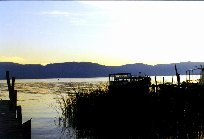
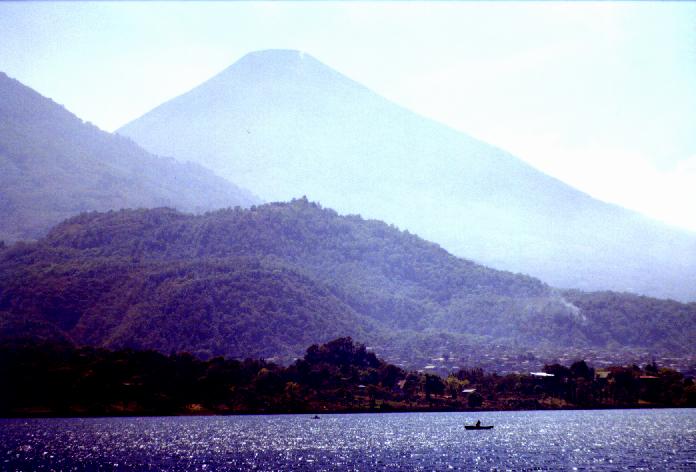
| Left: Dawn over Lago Atitl�n with
the silhouette of a volcano. San Pedro la Laguna.
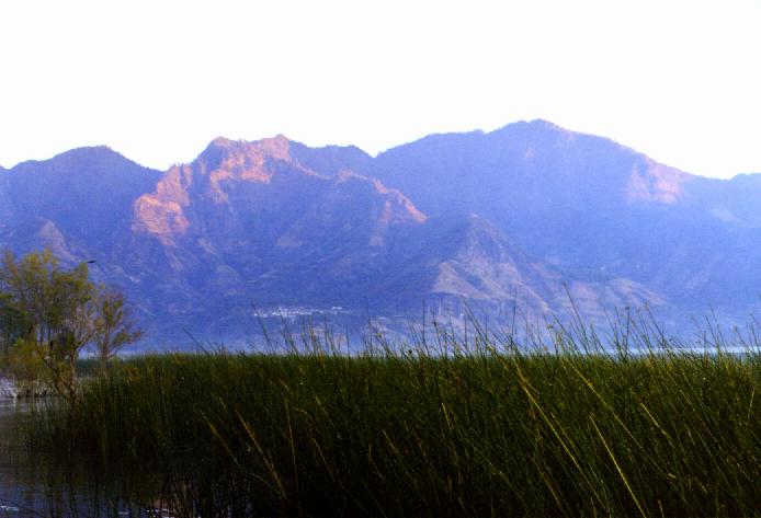
Right: Sunrise lights the top of the caldera wall across an arm of the lake from San Pedro la Laguna on Lago Atitl�n. A little village sits in near darkness still. |
 |
|
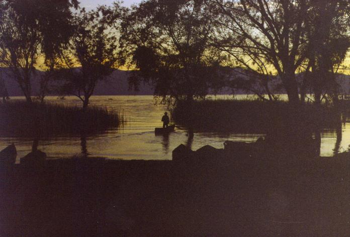
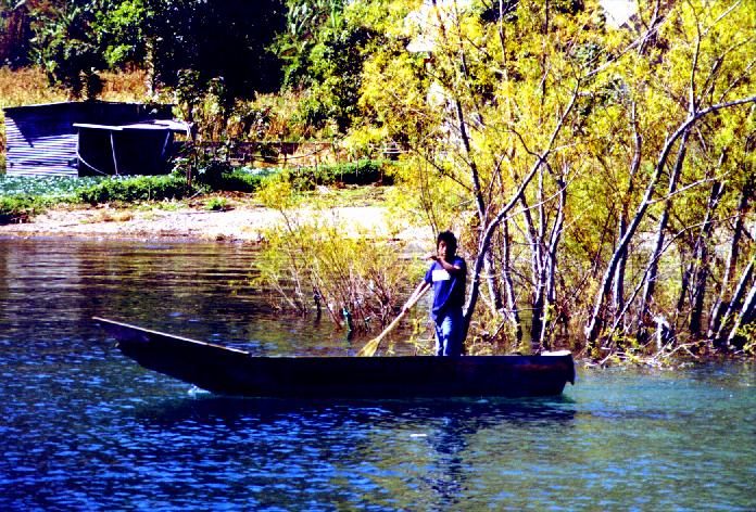
Left: One of the larger Lago Atitl�n launches waits for dawn at a rickety dock in San Pedro la Laguna. This type of boat costs about $1.50 - $2 US (12 - 16 Q) to go across the lake but the open smaller launches cost less and are faster. Right: A fisherman paddles his canoe through the reeds at dawn, Lago Atitl�n. San Pedro la Laguna. |
|
|
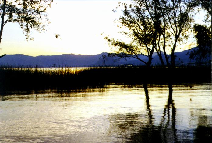
Left: Lago Atitl�n seems to glow in the pre-dawn light, where willows and reeds grow out of the water. San Pedro la Laguna. Right: Fisherman dot the lake at dawn in the glowing water. San Pedro la Laguna. |
 |
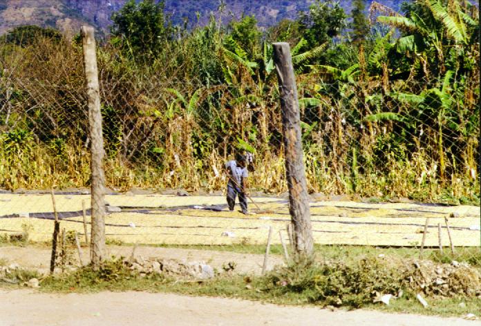
| Left: A farmer rakes his drying
coffee beans with banana trees behind him, in San Pedro la Laguna.
Small farms of corn, coffee, beans, bananas, and other crops dominate in
this rough country around Lago Atitl�n - no big commercial plantations (fincas) in this part of the country.
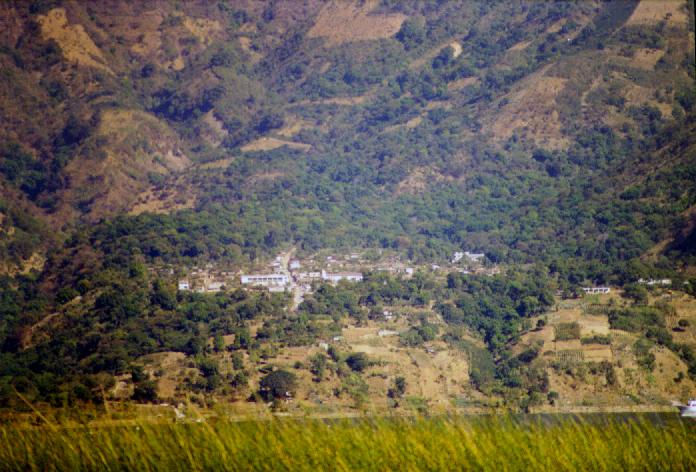
Right: The village of San Pablo la Laguna perches on a bench above the lake, viewed across a narrow bay from San Pedro la Laguna. Slopes above and below are patchy with woods and small, steep fields. |
 |
| Left: A fisherman waits for a launch
to get out of his way, standing in his tiny canoe made entirely of
straight pieces of board. Near San Pedro la Laguna.
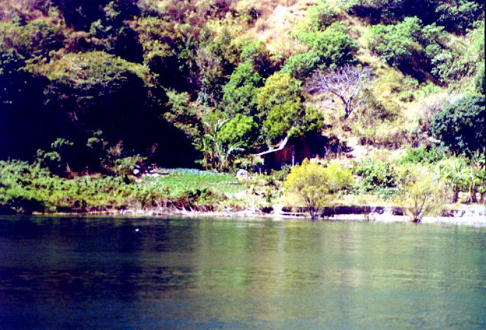
Right: A remote home and garden patch on the southern shores of Lago Atitl�n. Near San Pedro la Laguna. |
 |
| Santiago Atitl�n, on the south end of Lago Atitl�n, was an important city in colonial times but has been bypassed by "progress," leaving the fine colonial plaza intact. It can be reached by car or truck but it's a rough, long road and most traffic comes by the lake. Despite the steady influx of tourists, many French, it keeps its traditions better than most villages of its size, with even most of the men wearing traditional clothes. The village doesn't allow cars (there are few here anyhow) or even bicycles on the plaza! I rode over on a launch which made stops at remote beaches to drop off or pick up passengers. I spent the rest of the day there, visiting the cathedral, a shrine to Maxim�n (a cross between a Mayan deity and a Catholic saint), and talking with the children of the town. However, I caught a launch back to quiet San Pedro for the night. | |
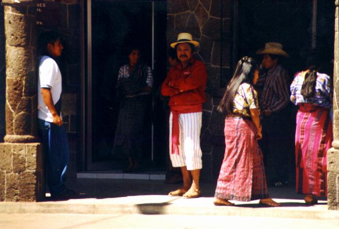
| Left: Volc�n Atitl�n looms over Santiago Atitl�n
as my launch nears.
Right: Local folks in Santiago Atitl�n wait their turn to go in the bank. The man looking at the camera is wearing the traje (traditional clothes) of Santiago Atitl�n. |
 |
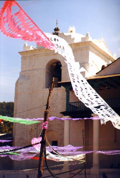
| Left: Banners flap in the wind off the
lake in the plaza by the ancient church in Santiago Atitl�n - part of the
preparations for a fiesta.
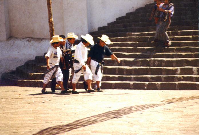
Right: Indigenous men in Santiago Atitl�n, wearing traje carry something large for the fiesta across the plaza and by the steps of the colonial church. |
 |
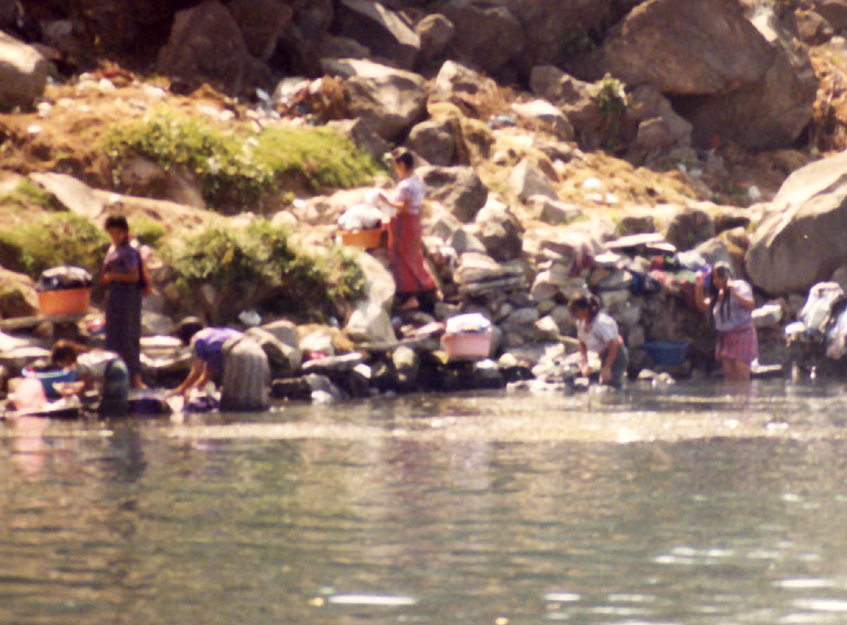
| Left: The women of Santiago Atitl�n
wash clothes, babies, dogs and themselves in Lago Atitl�n.
Right: A traditionally dressed woman in an especially spectacular headpiece - similar to the one on the 25 centavo coin - scolds a grandson as they wash up in the lake, Santiago Atitl�n. |
 |
| I returned to San Pedro La Laguna then on Sunday rode another launch to Panajachel, or Gringotenango as it is usually called. Gringotenango is the easiest place to get to on the lake and there is no traditional village - it's a tourist town pure and simple. Not a pleasant place though like the rest of the lake the views are spectacular. From there I caught a bus to the Interamerican highway and another to Xela Sunday night, to begin my second week of being tutored. | |
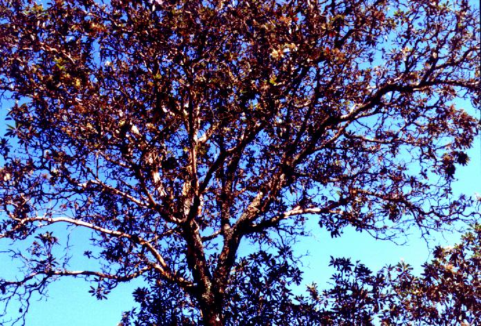
| Left: Madro�a trees in the higher
areas made me feel right at home. Other trees I recognized in the
highlands included alders, at least two types of pine, at least two types
of oak, something that looked like a chinquapin, elderberry, and two types
of "tree" tobacco. Near Xela.
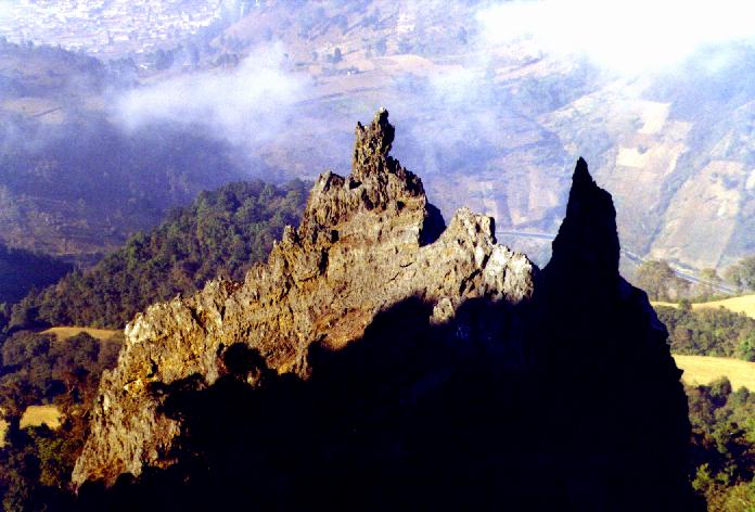
Right: Looking down from the saddle between the peaks of Las Muecas, an eroded volcano. Outcrops below are half in shadow, and in the distance you can see part of Xela. I climbed the mountain with two of the six young ladies from Centro Maya, who are going to college at Universidad San Marcos in Xela on a scholarship from the Centro Maya. Near Xela. |
 |
| On
my last weekend in Guatemala, I went to Chichicastenango (Chichi) to
see the Sunday market. It's purported to be the biggest periodic market in Central
America, and is in a strategic location where trade routes from the
tropical Pacific coast and Atlantic lowlands, all the highlands, and the
urbanized area around Guatemala City all meet. Tourists have discovered it
en masse but it's still great, I think, both the tourist parts of the
market (around the edges) and the
central parts where tourists don't venture as much (and when they do,
structures built for much shorter indigenous folks endanger our health). There are a lot of
tourists in town on Sundays for the market, but most come from Lago
Atitl�n or Antigua by shuttle and leave the same day. As a result, it's
not too bad for folks like me (avoiding gringos) outside of a few hours
from about 10 - 2 on Sunday. I saw a spectacular religious procession
(left), and really
enjoyed the market (I'm a market lover everywhere I go). Most of the
things I bought on the trip I bought there as I had been traveling very
light up until then.
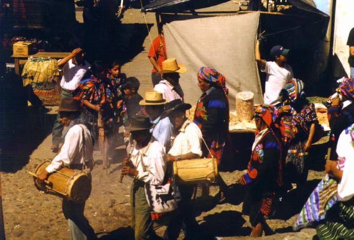
The next series of pictures is of a Maya-Catholic religious fraternity or cofrad�a in Chichi. They are parading through the still partly empty market on a Saturday evening, just before Saturday night mass. This is the most important mass of the week there because Sunday is market day and a lot of folks lack time to go to mass. The retinue has drums, flutes (both single flutes and reed flutes similar to Andean ones), chanting, and incense, all accompanying a figure of a saint carried in a glass-fronted case. A few gringos followed, most a bit less respectful than I try to be. |
|
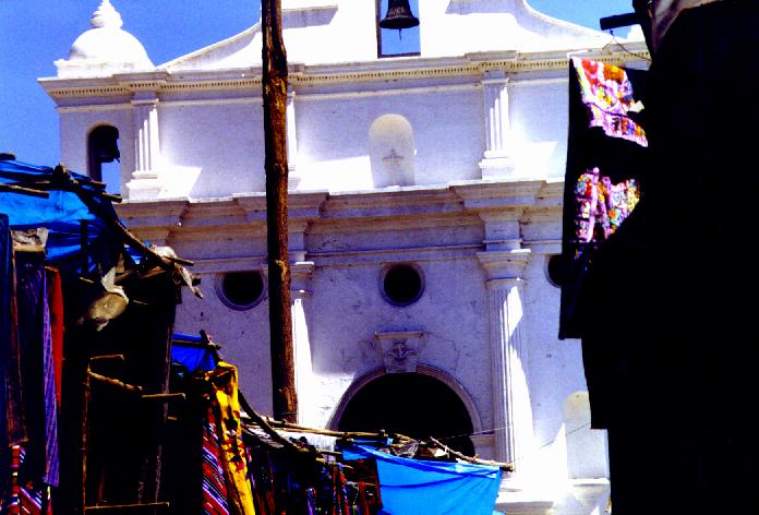
| Left: The old church in
Chichi - I was outside it with camera when the cofrad�a
burst out of a building next to the church and began the procession.
Right: The cofrad�a parades by partly assembled market stalls. Chichicastenango. |
 |
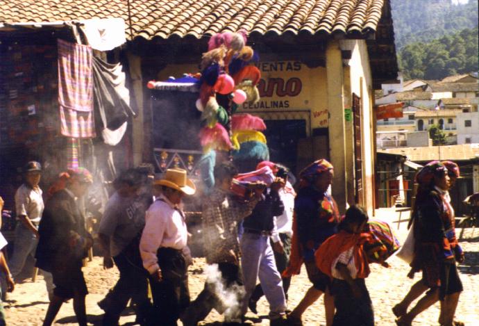
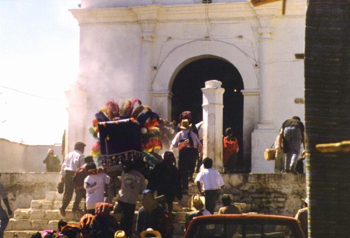
| Left: Clouds of incense surround the
saint's highly decorated case as the cofrad�a continues through
the town. Chichicastenango.
Right: The incense really is going now as the cofrad�a stops at another church. The smoke is from cans of incense swung hard to fire it. They faced the four cardinal directions then returned to face the other church, then a very decorated man danced, swinging a unit that reminded me of a prayer wheel. Soon fireworks began to shoot out randomly from the wheel - effectively scattering the two gringos bolder than me who had stuck their noses into the ancient and holy procession. Chichicastenango. |
 |
|
The festive colors of the cofrad�a's procession get lost in the everyday colors of the preparations for tomorrow's market as they continue on their route through the town. Chichicastenango. |
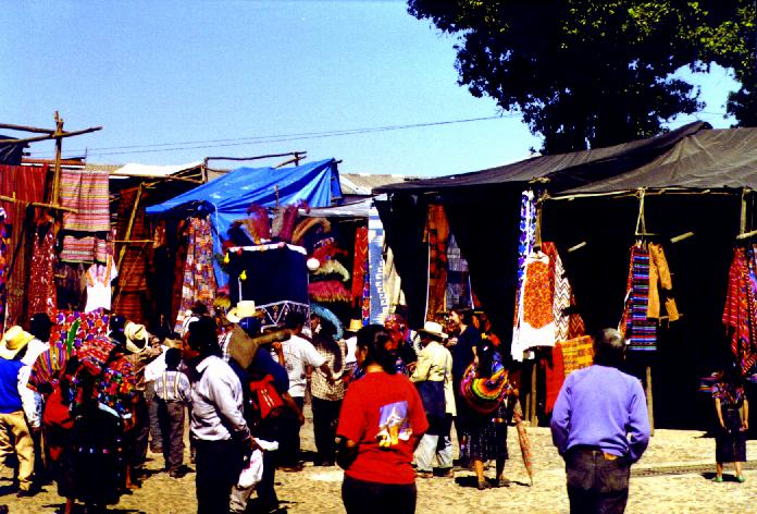 |
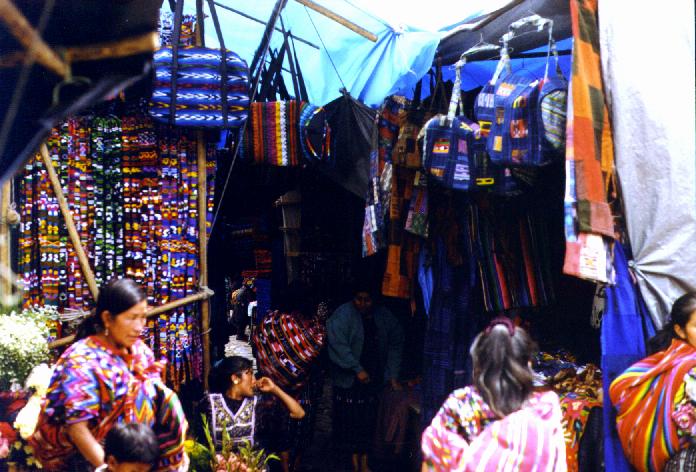
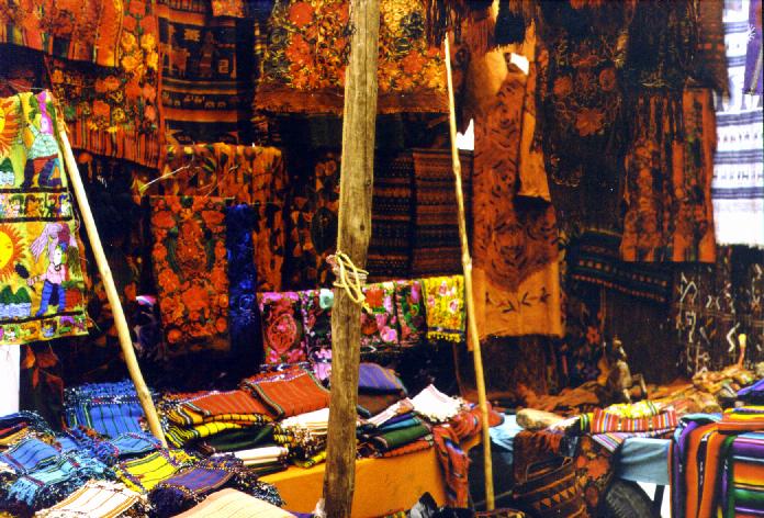
| Sunday market in Chichi! It's purported to be the biggest periodic market in Central America, and is in a strategic location where trade routes from the tropical Pacific coast and Atlantic lowlands, all the highlands, and the urbanized area around Guatemala City all meet. tourists have discovered it en masse but it's still great, I think, both the tourist parts and the central parts where tourists don't venture as much and when they do, structures built for much shorter indigenous folks endanger our health. Chichi is a great town, perched on a mountaintop, very old (it was a Mayan capital before the conquest) and colorful. The market day was all it was cracked up to be and the tourists disappeared into the crowds of locals. The colorful array of fabrics around the market (left) could keep you occupied for hours or even days. | |
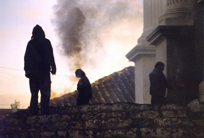
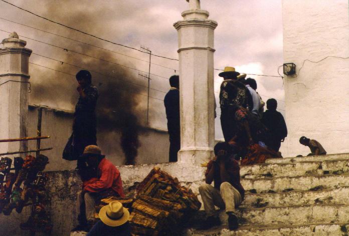
| Left: Indigenous men and women on the
steps of the church swing cans of incense to get a good cloud of smoke
as the first rays of sun hit the roof next door. Chichicastenango.
Right: Black incense smoke rolls up from the church steps. The incense is made from copal bark and pine pitch. Chichicastenango. |
 |
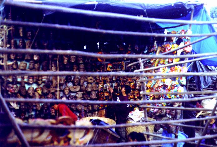
| Left: Dawn, Sunday in the
market - two vendors get an early start hanging masks, seen through an
empty stall of a less industrious vendor! Chichicastenango.
Right: Flower vendors cluster at the foot of the church steps selling flowers to take as offerings to the church. Chichicastenango. |
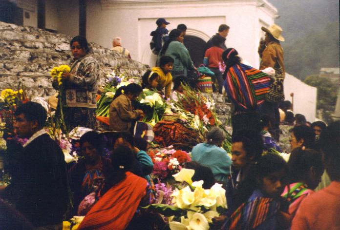 |
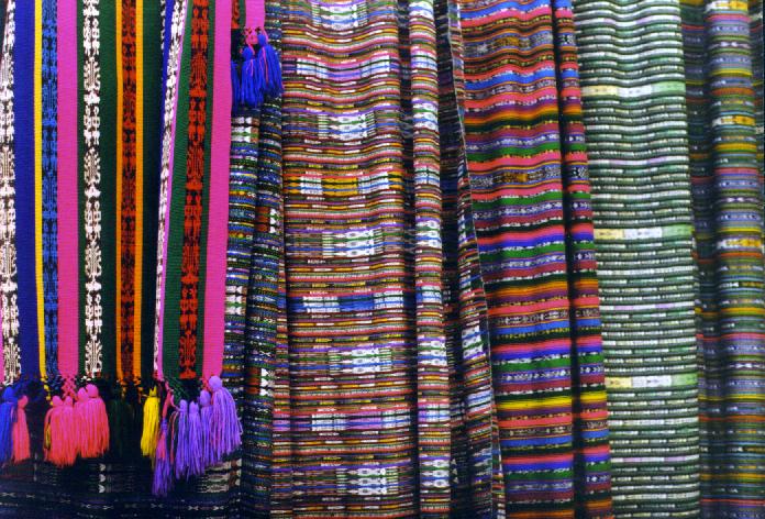
| Left: Still more woven and
embroidered fabrics on sale in
the mercado in Chichi.
Right: Hand-woven fabrics on sale in the mercado in Chichi. |
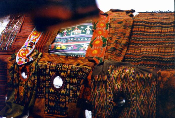 |
| Left: More fabric as well as
tourist-oriented goods and the colorful and friendly vendors.
Chichicastenango.
Right: Woven and embroidered fabrics on sale in the mercado in Chichi. |
 |
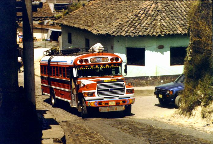
| Left: A typical Guatemalan bus -
an ancient, highly decorated, decommissioned Bluebird school bus from the
US - climbs a steep stone street in Chichi. While built for about 40 US
children, they often have 80 folks of all ages squeezed on, plus luggage
on the roof. Notice that the name of the bus is "Beautiful" (in
English).
Eventually, however, I had to catch a bus out of town and get to Guatemala City for an early plane back to Washington and work... |
 |
Back to Tim's Home Page
--
-- Last edited September, 2010