Pictures from Anza-Borrego Desert State Park
Anza-Borrego Desert State park, a National-Park-Quality state park in southern
California, is one of my favorite places on earth. I go there to escape from the rest of
southern CA on my trips there to visit family! I love my family but southern CA's cities
drive me nuts and "escapes" to the desert or nearby Mexico really help.
I hope to spend a bit of time there in the winter of 2002 to get some new
pictures.
The California State Parks Anza-Borrego Desert State Park
Web site says: "With over 600,000 acres, Anza-Borrego Desert State Park is the largest
desert state park in the contiguous United States. 500 miles of dirt roads, two huge
wilderness areas (comprising 2/3 of the park) and 110 miles of riding and hiking trails
provide visitors with an unparalleled opportunity to experience the wonders of the
Colorado Desert. The park name is derived from a combination of the name of Spanish
explorer Juan Bautista de Anza and the Spanish word "borrego," referring to
bighorn sheep. The park features washes, wildflowers, palm groves, cacti and sweeping
vistas. Visitors may also have the chance to see roadrunners, golden eagles, kit foxes,
mule deer and bighorn sheep as well as desert iguanas, chuckwallas and four species of
rattlesnake."
The park is the nation's 2nd largest state park and California's biggest. A wide
variety of terrain, climates, and landscapes make it especially interesting. Geologically,
biologically, anthropologically, and scenically the park is full of attractions. Among
them, the many native palm groves (oases) are my favorite attraction.
The palms are Washingtonia filifera, California's only native palm. They
are in very common horticultural use in the coastal parts of California (and many other
parts of the world) though as native plants they are only found in California and parts of northern
Mexico in scattered
groves in the desert (although I have heard reports of one or two small groves
in Arizona). The groves are full of life, a sort
of focal point for the insects, mammals, and birds of the desert. Many have small streams
or pools under the palms, and the best have never been burned by accident or vandals.
I also love the landscapes of grainy granitic rock, a sample of which
forms the background of this page.
Palm Pictures:
(click on link or thumbnails for bigger picture)
Other Desert Pictures:
(click on link or thumbnails for bigger picture)
For most of these pictures, see 7.5 minute (1:24000) scale USGS quadrangles
for "Sweeney Pass
CA" and "Sombrero Peak CA." There are a number of other maps USGS quadrangles of Anza-Borrego;
see a good index to get an idea of them all. At the 7.5 minute scale, maps that
include at least a part of Anza-Borrego include Borrego Palm Canyon, Clark Lake,
Fonts Point, Seventeen Palms, Tubb Canyon, Borrego Sink, Borrego Mountain, Shell
Reef, Julian, Earthquake Valley, Harper Canyon, Borrego Mountain SE, Monument
Peak, Agua Caliente, Arroyo Tapiado, Carrizo Mountain NE, Sombrero Peak, Sweeney
Pass, Carrizo Mountain, Jacumba, and In-Ko-Pah Gorge.
The palm pictures are in Mountain Palm Springs (an easily reached group of
several groves in southern Anza-Borrego), and in nearby Bow Willow Canyon, a somewhat more
strenuous hike. Both areas are near the pleasant (pay) campground at Bow Willow Ranger
Station and the primitive (and RV over-run) camp at Mountain Palm Springs.
Anza Borrego Links:
 Approaching Bow Willow palms from downstream, about
where the going gets a bit tough! 1998
Approaching Bow Willow palms from downstream, about
where the going gets a bit tough! 1998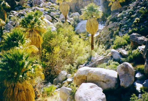 Looking down into part of Bow Willow palms
from the
canyon side, showing what a jumble of boulders it is. 1998
Looking down into part of Bow Willow palms
from the
canyon side, showing what a jumble of boulders it is. 1998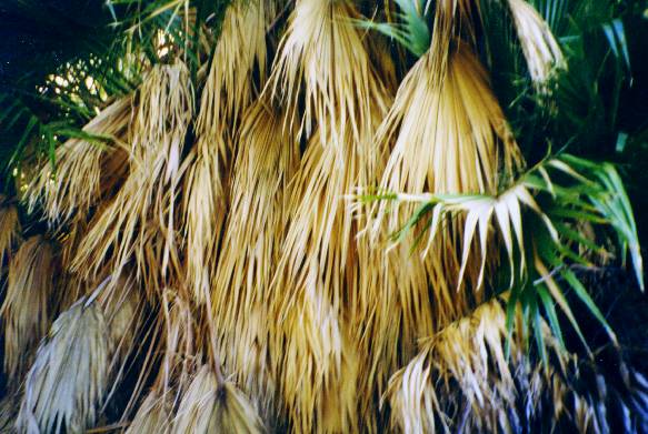 I love the textures of the skirts of dead palm leaves,
here seen in Bow Willow Canyon. 1998
I love the textures of the skirts of dead palm leaves,
here seen in Bow Willow Canyon. 1998 Palms in Southwest Grove, near Mountain Palm Springs.
Note the full skirts of unburned dead leaves - these represent leaves from the tree's
whole life! 1995
Palms in Southwest Grove, near Mountain Palm Springs.
Note the full skirts of unburned dead leaves - these represent leaves from the tree's
whole life! 1995
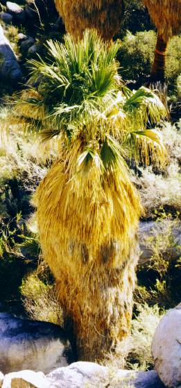 A single palm in Bow Willow Canyon lit by late
afternoon light. 1998
A single palm in Bow Willow Canyon lit by late
afternoon light. 1998
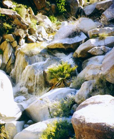 The top of a nearly hidden young palm (probably about 12 - 14 feet across)
gives scale to a waterfall at Bow Willow Palms during a very
wet winter. 1998
The top of a nearly hidden young palm (probably about 12 - 14 feet across)
gives scale to a waterfall at Bow Willow Palms during a very
wet winter. 1998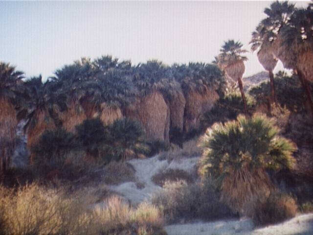 Here's another part of Southwest Grove. The dense
growth in the middle has a nice stream and small pools under it. On the hot winter day I
took this picture, the grove was buzzing with bees, hummingbirds, and other life. 1995
Here's another part of Southwest Grove. The dense
growth in the middle has a nice stream and small pools under it. On the hot winter day I
took this picture, the grove was buzzing with bees, hummingbirds, and other life. 1995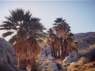 This is part of the Pigmy Grove, a somewhat stunted
grove with no surface water (and few young palms) near Southwest Grove. These palms have
been burned in the past but are growing new small skirts. 1995
This is part of the Pigmy Grove, a somewhat stunted
grove with no surface water (and few young palms) near Southwest Grove. These palms have
been burned in the past but are growing new small skirts. 1995
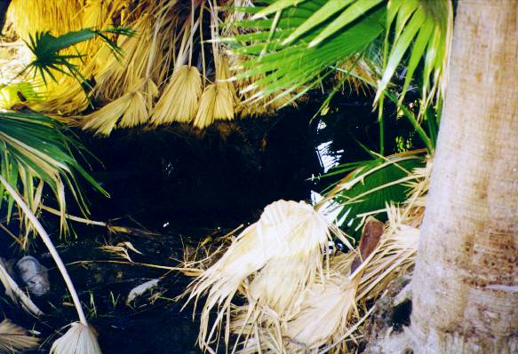 This little pool at Southwest Grove, Mountain Palm
Springs is under a dense growth of palms. I think the mixture of dead and living leaves and light
and shadows under the palms makes interesting patterns. 1998
This little pool at Southwest Grove, Mountain Palm
Springs is under a dense growth of palms. I think the mixture of dead and living leaves and light
and shadows under the palms makes interesting patterns. 1998 The rocky wilderness of Bow Willow canyon near the
lower palms.
The rocky wilderness of Bow Willow canyon near the
lower palms.
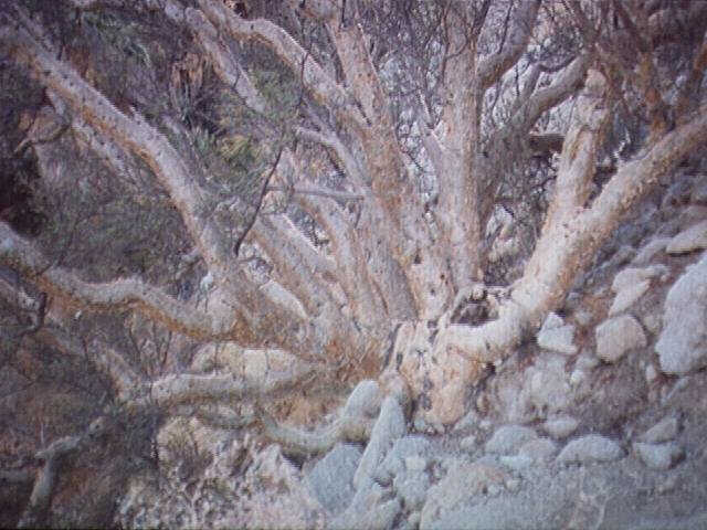
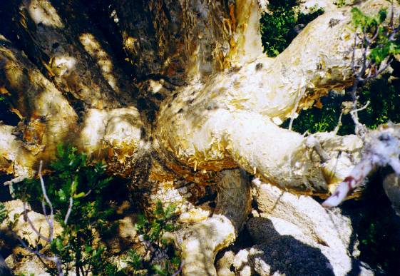 Another terote, also near Mountain Palm Springs
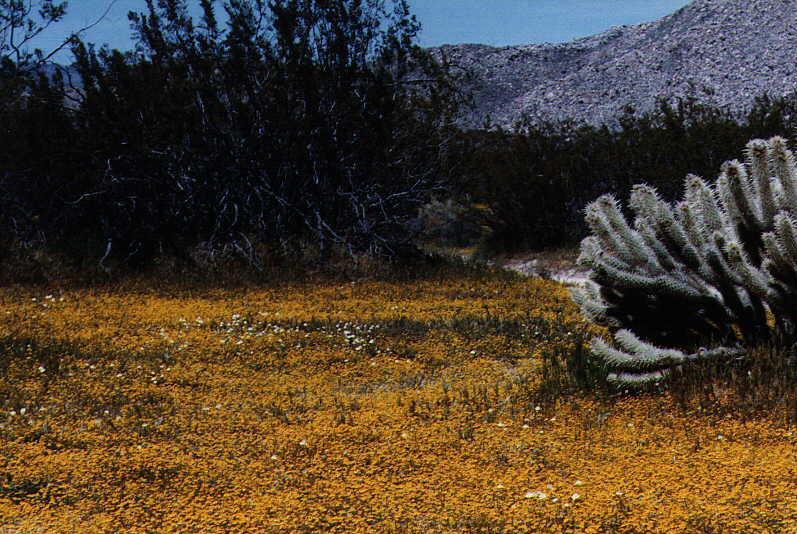 Flowers carpeting the valley floor
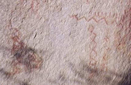
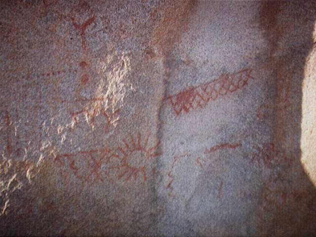 Petrographs near Blair Valley
